Friday, November 30, 2007

GoogleGeek stuff

Thanks Dominic for this link to USGS quad sheets for Google Earth. They are much better resolution than the ones released by Penn State.

Here's a link to the National Snow Analyses Center if you want to lay current snow cover over your Google Earth. Not much more useful than the snow cover website itself, since you have to download a new KML each time you want it.

click this (sorry if it doesn't open in your browser, seems to be a Blogger problem...)

This week, my work sites were talking about this new terrain feature in Google Maps. Pretty is a good word for it. Somewhat useful for planning and visualization. Would be nice to see this imagery get into Google Earth too, though my work sites say it's going the other way. That GE will be gone in a couple years, with all the functionality being moved over to Google Maps, (allowing for easier display in our cars and phones?).

Monday, November 26, 2007

V---a Trail

I don't know how this trail came into the inventory, but it is one fine selection. Twas part of a Tomi-Special loop yesterday, 4+ hours of quality singletrack that I don't usually ride.

Leedin'

Ancient Pete and the Hemlock

BTW, Has anyone noticed that Google Earth has upgraded the imagery for Pennsylvania? It's much better resolution, they're taken airplane rather than LandSat. But it's still an old photo for Michaux. Its shows the empty reservoir as not.

to add PA quad maps to your Google (use the transparency to lightly show overtop the imagery)

Wednesday, November 21, 2007

Tuscarora Trail

One more thing about the Buzzard Rocks, Shawl Gap area. The Tuscarora Trail is the trail we climbed up to Shawl Gap. The same Tuscarora Trail that begins near Carlisle. Food for thought....

Tuesday, November 20, 2007

the Fort Valley

click to engorge

For any who may be curious, here's a shot of the Fort Valley. We rode (sans Cupcakes) the top northeast section. These ridges are ridable with trails all the way to Harrisonburg and the ski area. Some of this was in this year's Tour, and the southern bit of Kaylor's Knob has been often featured in the Tour.

Monday, November 19, 2007

Buzzed Rox

The trail on the Massanutten East ridge was riding very dry and leafy yesterday. The leaves made it pretty sketchy in a lot of places and they hid lots of wheel traps. Leaf surfing is not something I like to do a whole lot of on this trail, but we all made it through fairly well, though we did miss a few attempts at tricky sections since the leaves covered the good lines.

It was a pretty tough 5-hour tour, especially on singlespeeds. We climbed up Shawl Gap from the Day Use Area, then Buzzard Rocks Trail down to the Buzzard Rocks parking lot, then down the road to Sherman Gap Trail. Hike-a-biked up Sherman for about an hour (or more?). Refueled and froze at the top, then rode the ridge from Sherman Gap to Shawl Gap.

For years I've been telling people that this 2-mile ridge section is one of my favorite pieces of trail anywhere in the GWNF. But I wasn't feeling that much love from it yesterday. I was whipped hard from the Sherman slog. The leaves were covering the rocks that I usually try to stay on top of and it was hard to take as many chances as usual. But, I drained the legs anyway, trying to clean as much as possible knowing that we had no more climbs ahead. That last bit of trail dropping into Shawl Gap brought the smile back to my face. And, just as the smile was returning to Darius' face, this happened on the last rock steps. He evac-bailed left into the rock face. For those who know this trail, you know how ugly that coulda been if he fell right-side.


Martin early on the Buzzard Rocks ridge

Was good to ride with Buchness again. Mike and I go way back in GWNF experiences.

NOTE: No Cupcakes were harmed in the making of this ride.

Thursday, November 08, 2007

One year in PA

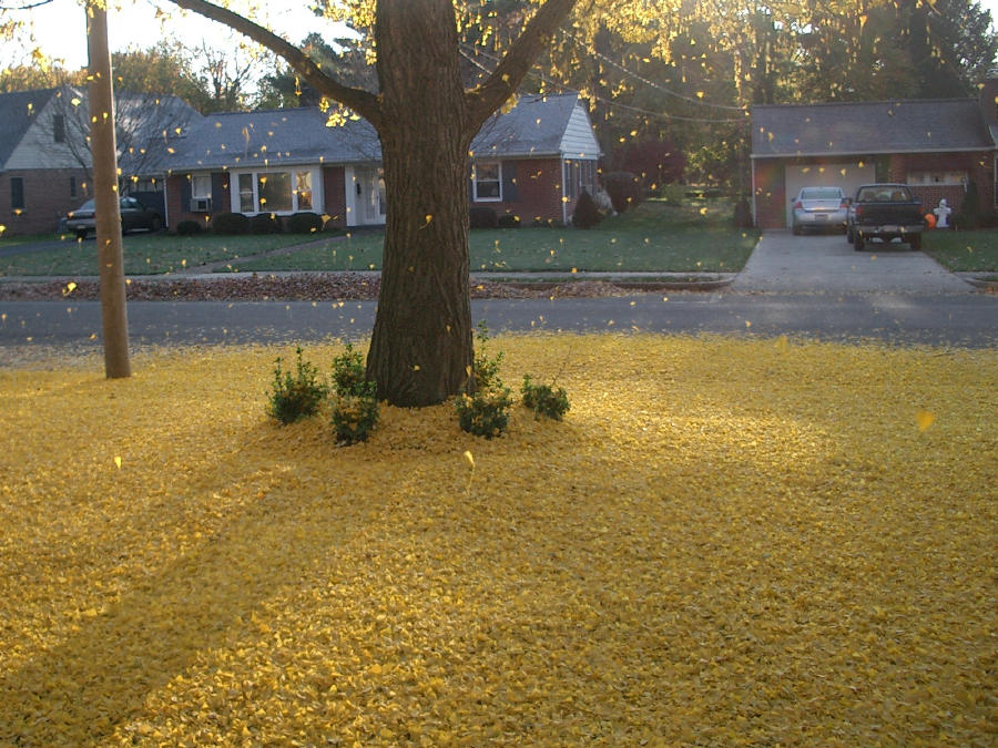
We've been in Chambersburg a year now, and it couldn't be much better. One way I know it's been a year is this is happening again. Since I photo'd this same thing last year, on Nov 4th

Here's today's pic, on Nov 8th. Since these Ginkos drop their leaves in one day, I wonder if the date is some kind of climatic indicator? The amount of daylight remains the same, the amount of precip and temps don't. They're dropping greener than last year too, and on the first really cold morning (25 degrees). I wonder what the temp was last year when they dropped? (Easy enough answer to find....29 degrees, also the first morn' in the 20s last fall)

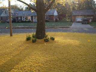
This year I have a bright idea of putting tarps out to catch some of the leaves. Then all I'll have to do is drag them out to the curb. Obviously, I don't have enough tarps...

Leaves also played a role in my frustrating search to find and learn the good mountain bike trails in the Forest. After being busy getting moved in, I'd get out to Michaux any chance I could and try to learn something. I remember getting totally lost off the trail on Lower Buckets, Rattlesnake Ridge, and Lewis Rocks (in the dark w/ no lights) to name a few. But leaves certainly weren't the only reason I had trouble finding the trails. I whined constantly that they're just freakin' hard to find and figure out. My maps were so useless that I made up my own trail map of Michaux (click below).

Finally, the Cupcakes included me on their e-mail chains which on every Sunday, led to a cool ride. I tried to ride fast and keep up, keep my mouth shut, and bring my share of beers and treats. But I couldn't keep quiet. I never complained about the ride being too long, or the trails too hard, but I peppered everyone with questions like "...what's the name of this trail? Where does that one go? How do you get to such & such from here....?" I rarely got an answer that I really understood.... And then I'd be dropped, off the back on some rocky descent, passing numerous trail junctions that I hoped the group didn't take, hoping they were waiting at the bottom of something for me...

I also did some exploring west of here. Went to the Tuscarora Trail a couple times, and thought I'd be back often (I haven't returned). X-C skied a couple times at Sideling Hill and thought I'd be back to explore by bike (I haven't). Skied the Laurel Mountain area a couple times, and I will be back there for sure.

In my year here, I also learned a lot of cool bike trails from this guy, and drank barrels of good beer with him.

Here's to another great year in the Pennsylvania forests with new friends!

Monday, November 05, 2007

the Sunday ride

A big group yesterday.
TG was out in force, which meant plenty of stops,
but the KeeferKeefer factor kept the pace pretty high in between those times.
We had a few folks who bailed out at various spots. I think many peeps were pretty whipped, I know I certainly was on the last trail section, H-3, or Campsite-3, or Hansel & Gretel-3 or whatever we call it. I led the pack through Campsite-2 Trail and cleaned it, then faded fast on the ensuing Sketch City descent and powerline hike-a-bike.

Back at the coldest spot in Michaux, we faced an unusual low number of beers for a group this size. It's nearly winter-time boys and girl, we need to up the beer time:ride time ratio. How are we gonna pull off a grand tour if we can't even load up the beers??

O.C. yesterday

Nice!
Our nephew Jake sent this shot of yesterday's surf in Ocean City, MD, courtesy of the remnants of TS Noel.